Indiana: Balloq’s medallion only had writing on one side? You sure about that?
Sallah: Positive!
Indiana: Balloq’s staff is too long.
Indiana: Sallah: They’re digging in the wrong place!
Raiders of the Lost Ark, (1981)
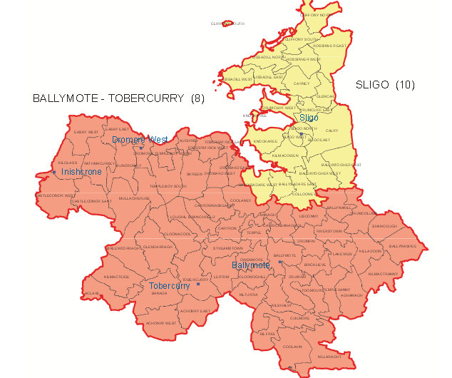
County Sligo, and the old Borough Corporation of Sligo town are roughly 400 years old, and both are creations of the British Empire and its nascent colonial enterprise in Ireland. As part of the Imperial project of extending centralised control across the country from Dublin, the counties were created as brand new entities on top of the earlier Irish Gaelic political territories. These older territories were called tuatha (countries). The tuatha that made up what is now County Sligo are shown on the map accompanying this article.
County Sligo was created by joining together the Gaelic tuatha of what was then known as Iochtar Connacht (Lower Connacht). This was made of five ancient tuatha. Each one had its own lord and public assembly. Each had a small army and system of law courts under the Irish law known as Fenechus (Brehon law). These tuatha in turn were arranged in a hierarchy, with the chief one in this area being Cairbre Drom Cliabh. So the local overlord at the time of the conquest was the chief of the O ‘ Conchobhar Sligigh (O’Conor Sligo), a family related to the O ‘ Conor kings of Connacht. The chiefs of the other tuatha were Ua hEaghra of Luighne, Mac Donnchadha of Tir Olliol and Corann and Ua Dubhda of Tir Fhiacrach. Each of these territories was renamed as well, they were called baronies and became electoral divisions under the British administration. Luighne became Leyney, Tir Olliol became Tirerrill, Tir Fhiacrach became Tireragh and so on.
Sligo Borough Council had been set up in 1613 as part of the reorganisation of territories under the English conquest. It extended in a circle one mile from the Market Cross. Some of the boundary markers still exist along the sides of the road. The county was an earlier creation, around 1585, of Sir Henry Sidneys “shiring” program under the Surrender and Regrant scheme intended to Anglicise the country.
The new county and borough structure obviously facilitated British rule from Dublin and the collection of taxes for the new administrators. But, the newly named counties served one other very important purpose. Simply by creating an entity with a new name, they disconnected the people from the earlier history of the country. Because the counties remained in operation after independence, this effect is still in operation today.
Under the new reality, the old chief families in every branch of Gaelic society were marginilised. Their history went back in many cases as long as the tuatha themselves which is about 1, 600 years, far longer than the counties that came after them. However their pedigrees and claims, no matter how ancient, were now worthless because they referred to territories that no longer officially existed. And so by a trick of the pen and the mapmakers artifice, Irish people became strangers in their own land.
As knowledge of the old territories faded with the loss of the Irish language in the area, so did the knowledge of how the land had been organised and connected to its Gaelic past. The placenames are the key to that connection, and without them we are blocked from understanding the ancient history of our area. For example, Cairbre is named after Cairbre Mac Neill, son of Niall of the Nine Hostages, and Tir Fhiacrach from Fiacra a half brother of the same ruler and one of the three Connachta from which most of the ruling tribes of Connacht traced their descent. That it was from this part of Connacht that the Ui Neill and Connachta dynasties expanded across the northern half of Ireland. is actually witnessed by the names of the territories. And others open connection to other histories and mythology, such as Corann, which is named after the harper of the Tuath De Danaan, who was granted the land after the second battle of Moytura. There are endless connections of this sort. You get the picture.
However, it is not only written history and mythology we are disconnected from. The physical remains around us are also cut off from the context in which they were created. This means they become mysterious and are subject to archaeological investigation as if they were prehistoric, even though we have extensive records available about their histories. This is a bizarre effect of using the wrong political boundaries to explain Irish history. To put it simply, we are using the wrong maps. To explain history, we need to understand the context of events, and the tuatha provide the context of most of Irish history. Therefore historical tourism is also suffering from this problem, as lack of information and awareness of the reality of Gaelic Ireland causes endless confusion as to how to interpret our past. We must be aware that every historic castle, church, monastery, ringfort. holywell and numerous other historic sites existed and were created within the tuath system, and therefore their placement and use is only understandable in relation to this political reality.

Which brings me to the present. History goes in cycles they say. When the government abolished the borough council of Sligo town, rolling it together with the county council to create two districts in County Sligo. The northern one is now called the Sligo Borough District. The aim, at least on paper, was to create a flatter hierarchy of local government and prevent duplication of services, although the open conflict between Sligo Borough Council and the central government over the Eastern link bridge can’t have helped.
However, when the new administrative boundaries were drawn something quite remarkable happened. The new Borough District is an almost exact match for the ancient tuath of Cairbre Drom Cliabh.
This has come about because the older territories reflected geographical and social realities that have not changed over the centuries, and because of their organic development, they represent these realities more accurately and subtly than the counties, which were imposed from the top down by a centralised and alien administration in Dublin.
Whatever the reason for its re-emergence as a political unit, it represents an opportunity to experimentally begin to revive the connections to the history of this part of Sligo. The way forward is simple. For the purposes of historical tourism the tuath name and maps should be used in all historical literature that deals with sites that predate the 17th century. This means most of our historic sites should be interpreted in this way. Signs should also mark the boundaries of these historic tuatha, and inform people when they are entering and leaving them. Of course, post 17th century historic sites, like big houses etc, should rightfully be set in their particular context, which is the English County system as we know it now.
By stripping away the colonial era layer, thousands of years of history, myth and culture will be accessible in a way that has so far eluded us, and the re-appearance of an ancient Irish tuatha, albeit accidently, shows that there are practical reasons why this would be beneficial, not only in Sligo, but across the whole country.